pitchMap
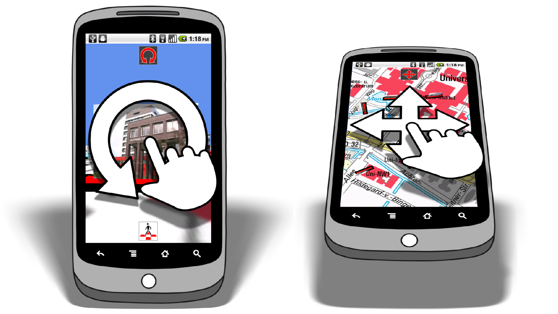
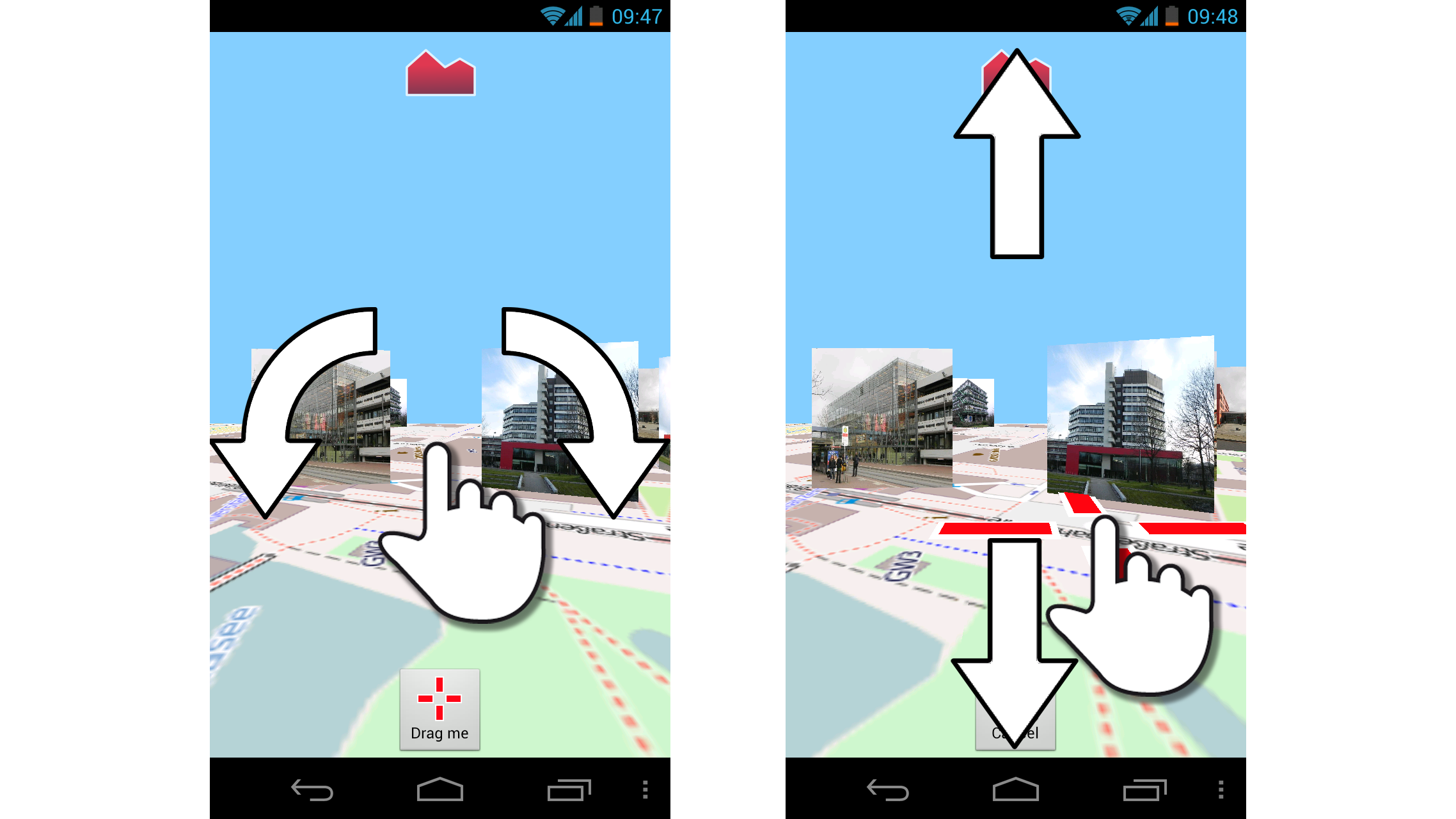
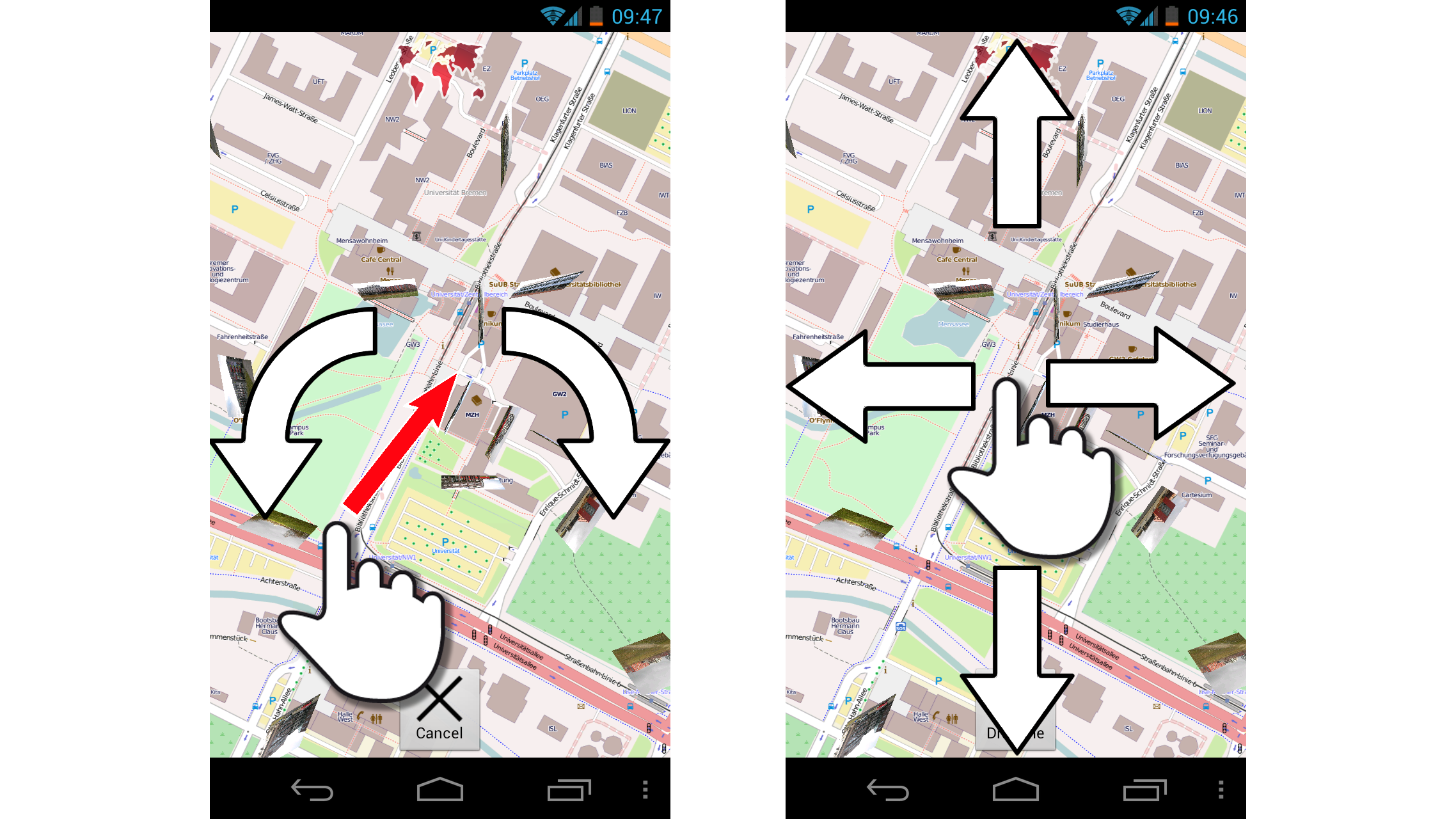
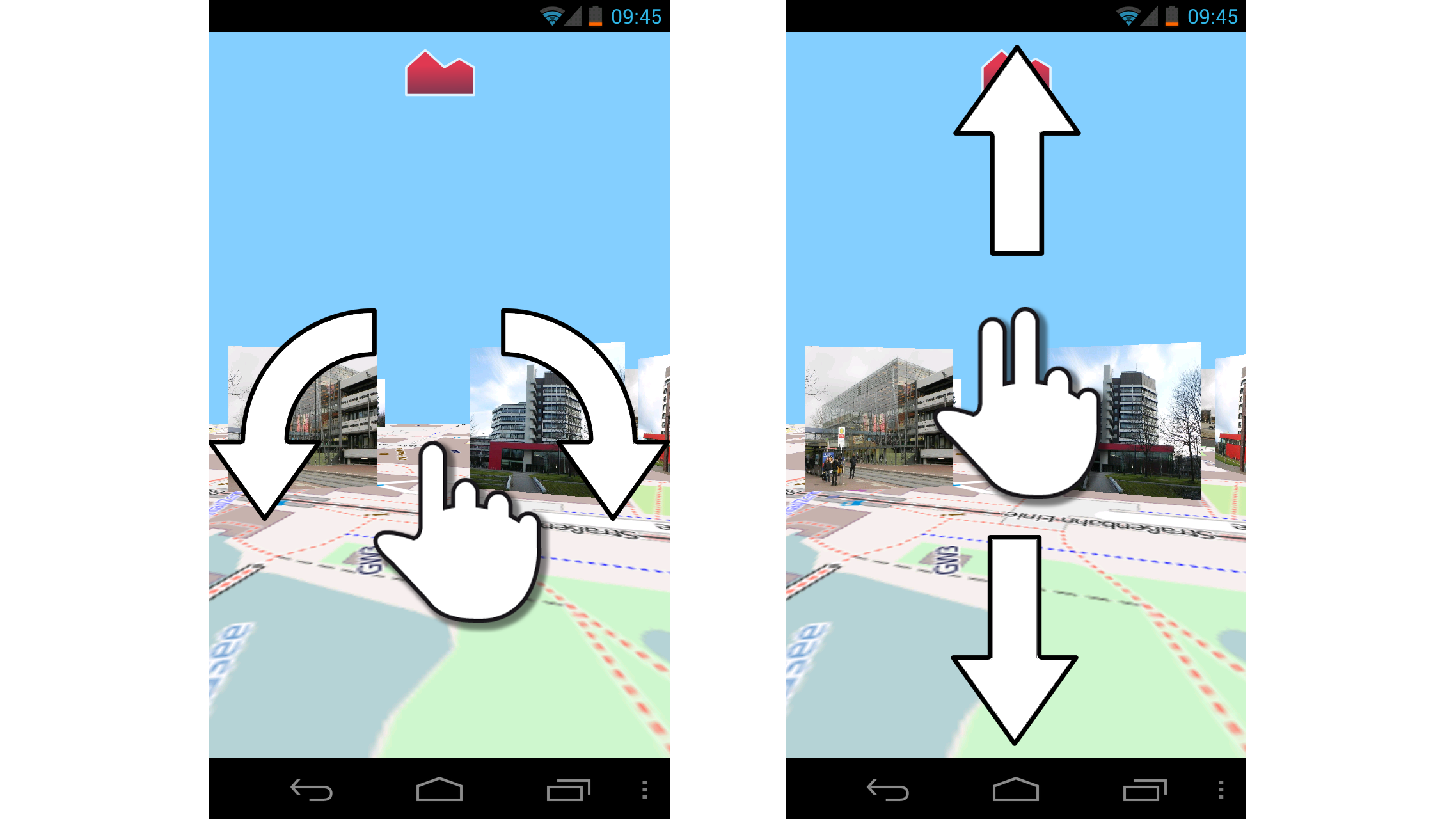
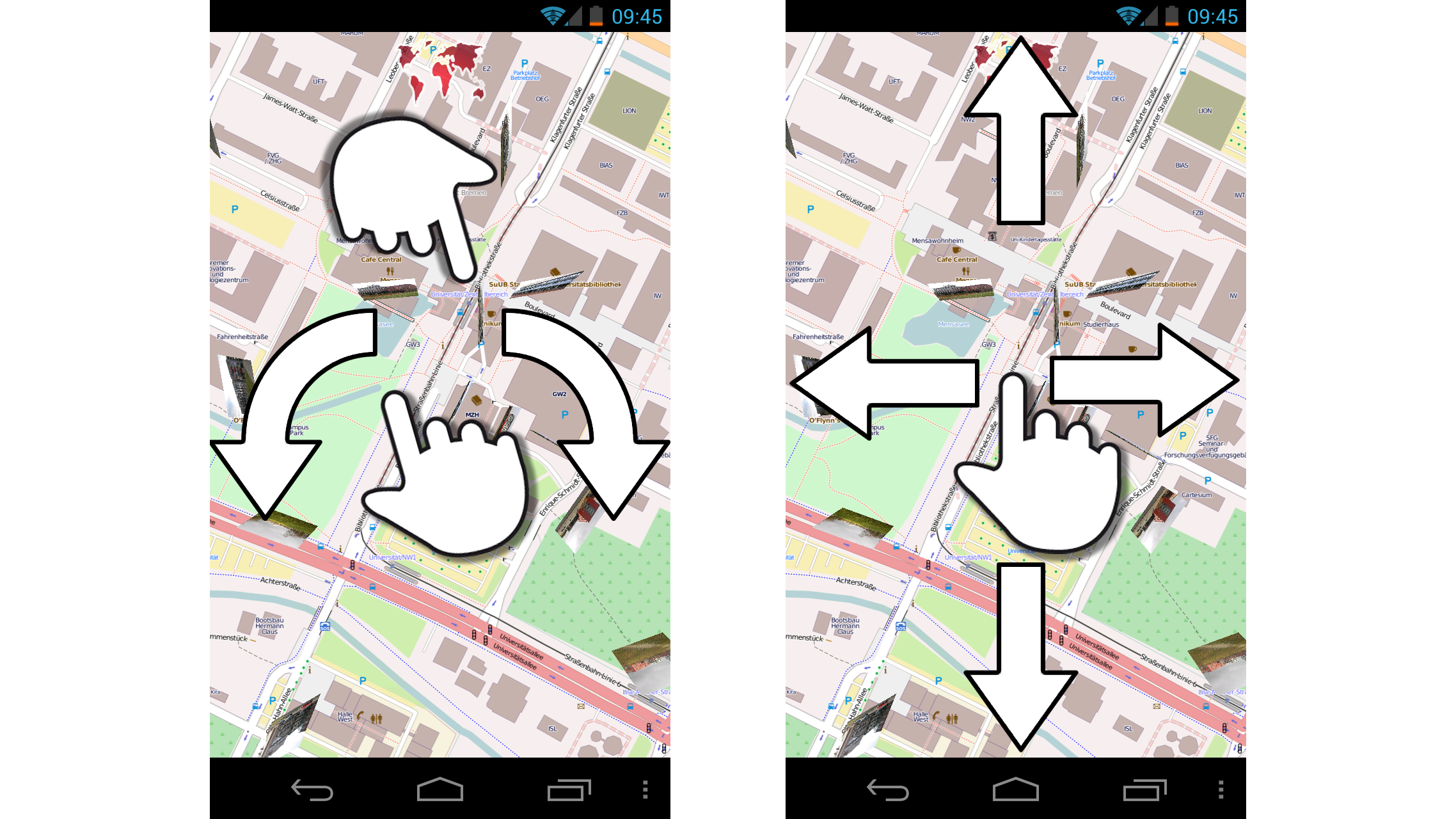
Mobile interaction concepts for navigation in 3d space are challenging. pitchMap combines a pitch gesture with a different meaning of touch depending on the device’s orientation
Mobile 3D-Interaktion zur virtuellen Exploration realer Umgebungen Dirk Wenig and Rainer Malaka
Kombinationen von topografischen Karten und fotografischen Bildern sind eine Möglichkeit, real existierende Umgebungen für eine virtuelle Exploration abzubilden. Werden hierzu georeferenzierte Fotografien senkrecht auf der Karte platziert, ergibt sich das Problem der Navigation im 3D-Raum. Diese Arbeit stellt hierzu unter Berücksichtigung der Beschränkungen und Möglichkeiten moderner Smartphones zwei Interaktionskonzepte für mobile Geräte vor.
Dirk Wenig and Rainer Malaka (2012) Mobile 3D-Interaktion zur virtuellen Exploration realer Umgebungen In M&C 2012, Demosession: Mensch & Computer Workshopband: interaktiv informiert - allgegenwärtig und allumfassend!?, 513-516. Oldenbourg, Munich. | BibTex
pitchMap: A Mobile Interaction Prototype for Exploring Combinations of Maps and Images Dirk Wenig and Rainer Malaka
While maps and images complement each other when combined in a 3d environment for virtual exploration, mobile interaction concepts for navigation in 3d space are challenging. Due to the lack of input devices, most of the interaction has to be realised on small sized touch screens. We present a prototype combining well-known interaction techniques using a discrete and a continuous pitch gesture.
Dirk Wenig and Rainer Malaka (2011) pitchMap: A Mobile Interaction Prototype for Exploring Combinations of Maps and Images In Smart Graphics 2011: Proceedings of the 11th International Symposium on Smart Graphics. Lecture Notes in Computer Science 6815. Springer, Berlin/Heidelberg. 10.1007/978-3-642-22571-0_23 | BibTex