StripeMaps Honourable Mention NUMA (2014)
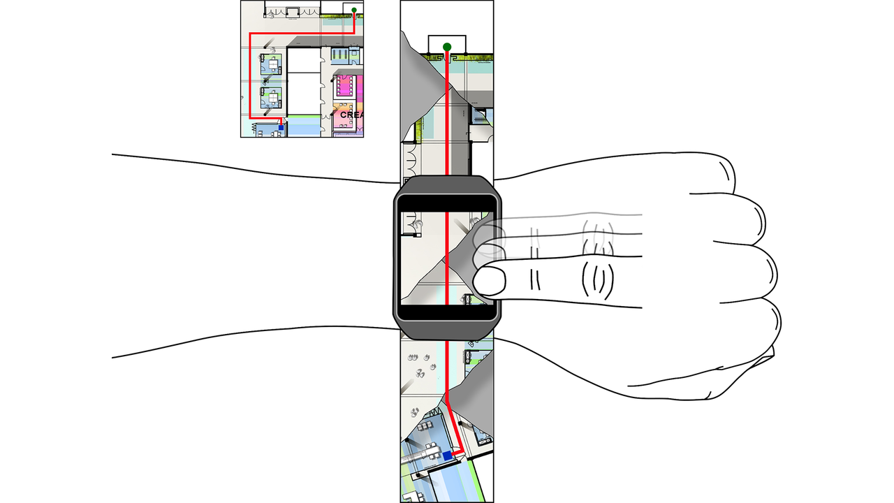
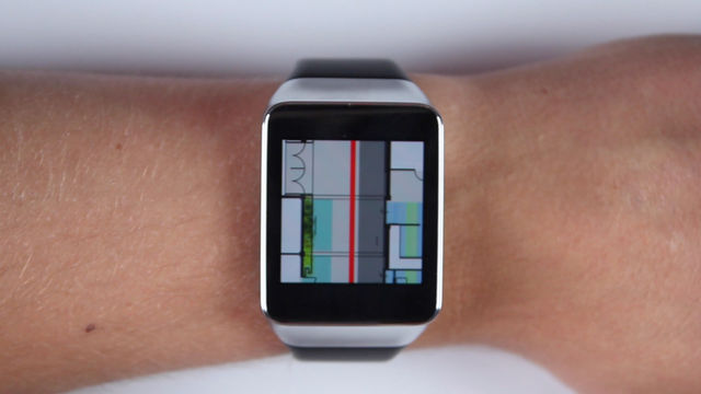
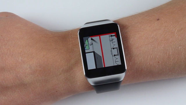
StripeMaps is a novel cartographic approach for maps on smartwatches. It transforms any two-dimensional route map into a one-dimensional "stripe" for easy interaction.
The Aesthetics of StripeMaps: Being Small and Beautiful Dirk Wenig and Johannes Schöning
Maps are a very powerful form of information visualization. Beside their main purpose to communicate often very complex relationships between elements of some space, “good” maps are often perceived as aesthetically pleasing and beautiful. Maps are collected for those reasons; since centuries and ages they are “beautiful” – over all trends. Cartography, the study and practice of making maps, has long tradition. Even today, most of the maps, e.g., road maps and public you-are-here maps, are still crafted by professional cartographers. However, maps do require space to be displayed while mobile and wearable devices are getting smaller and smaller. This presents new challenges in cartography, as designing aesthetic user interfaces is an important aspect in the area of HCI. With StripeMaps we present a technique to bring maps to very small displays without destroying their utility and beauty. In this workshop paper we discuss our design considerations in depth and open up the discussion for alternative approaches.
Dirk Wenig and Johannes Schöning (2016) The Aesthetics of StripeMaps: Being Small and Beautiful In MobileHCI '16 Adjunct, Workshop The Role and Impact of Aesthetics in Designing Mobile Devices: Adjunct Proceedings of the 18th International Conference on Human-Computer Interaction with Mobile Devices and Services, 1150-1154. ACM, New York, NY, USA. 10.1145/2957265.2965021 | PDF of Paper | BibTex
StrapMaps: Bringing Map-based Navigation to the Straps of Bags Dirk Wenig, Florian Heller and Johannes Schöning
Most outdoor activities and outdoor sports include a navigation component. For example, hiking, biking, mountaineering and climbing activities require orientation and wayfinding at certain points to certain degrees. With the rise of personal GPS devices, numerous navigation apps now exist that are tailored to the specific needs of outdoor enthusiasts. Nevertheless, they all have the common problem, that they require the users to “store” the mobile device in their pockets to have the “hands free” for interaction. While wearable devices such as smartwatches overcome this problem, they have the disadvantage that they often offer very small screen space. In this paper we present StrapMaps, a concept to bring interactive e-ink displays to straps of backpacks or harnesses to present map information while on-the-go in nature.
Dirk Wenig, Florian Heller and Johannes Schöning (2016) StrapMaps: Bringing Map-based Navigation to the Straps of Bags In UbiComp '16, Workshop UBIMOUNT - Ubiquitous Computing in the Mountains: Supplemental Proceedings of 2016 ACM International Joint Conference on Pervasive and Ubiquitous Computing, 225-228. ACM, New York, NY, USA. 10.1145/2968219.2993411 | PDF of Paper | BibTex
StripeMaps: Improving Map-based Pedestrian Navigation for Smartwatches Dirk Wenig, Johannes Schöning, Brent Hecht and Rainer Malaka
Map applications for smartwatches present new challenges in cartography, a domain in which large display sizes have significant advantages. In this paper, we introduce StripeMaps, a system that adapts the mobile web design technique of linearization for displaying maps on the small screens of smartwatches. Just as web designers simplify multiple column desktop websites into a single column for easier navigation on mobile devices, StripeMaps transforms any two-dimensional route map into a one-dimensional "stripe". Through a user study, we show that this simplification allows StripeMaps to outperform both traditional mobile map interfaces and turn-by-turn directions for pedestrian navigation using smartwatches. In addition to introducing StripeMaps, this paper also has a secondary contribution. It contains the first empirical comparison of different approaches for pedestrian smartwatch navigation and illuminates their pros and cons.
Dirk Wenig, Johannes Schöning, Brent Hecht and Rainer Malaka (2015) StripeMaps: Improving Map-based Pedestrian Navigation for Smartwatches In MobileHCI '15: Proceedings of the 17th International Conference on Human-Computer Interaction with Mobile Devices and Services, 52-62. ACM, New York, NY, USA. 10.1145/2785830.2785862 | BibTex Best Paper Award


